- Destinations
- Oregon
- John Day Fossil Beds NM
- Sheep Rock
John Day Fossil Beds National Monument is an area of active research. Fossils are continually being collected from all three units (Sheep Rock, Clarno and Painted Hills). Visitors may view a laboratory at the Sheep Rock Visitor Center in which specimens are prepared for scientific study and for use in future exhibits. This center also includes museum exhibits recovered in the John Day Basin. A visit to this center is a must and can be combined with some outstanding photographic exploits of the Sheep Rock which looms east across the valley from were the visitor center is located. A little bit more far away you will be able to explore and photograph the Blue Basin and Cathedral Rock, both situated some north of the visitor center.
Getting to Sheep Rock:
Your headquarters for this trip should be in Mitchell which means that your day trip is starting there. To get to Sheep Rock Unit and all the different attractions you take OR 26 heading east for approximately 26 miles. Merge left into OR 19 heading north. Three miles later you will already see to your left the visitor center. To reach you need to drive another 2 miles and to get to the Cathedral Rock another three miles from Blue Basin.
Blue Basin is marked with a sign and is to your right, while Cathedral Rock does not have any sign marking it. However it is such an impressive landmark that it does not need any sign, specially not for a photographers trained eye.
At the end of the day you just drive back to Mitchell to enjoy a rustic meal at Little Pine Cafe and afterwards rest at the Oregon Hotel.
Taking shots:
Depending on how comprehensive how you want to explore this part of the monument you should take as a minimum one day. Your day should start at sunrise at Cathedral Rock, followed by Blue Basin during early morning. As next I recommend the Visitor Center with its fossil displays to finally end the day with photographing Sheep Rock lit by the last sun rays of the day.
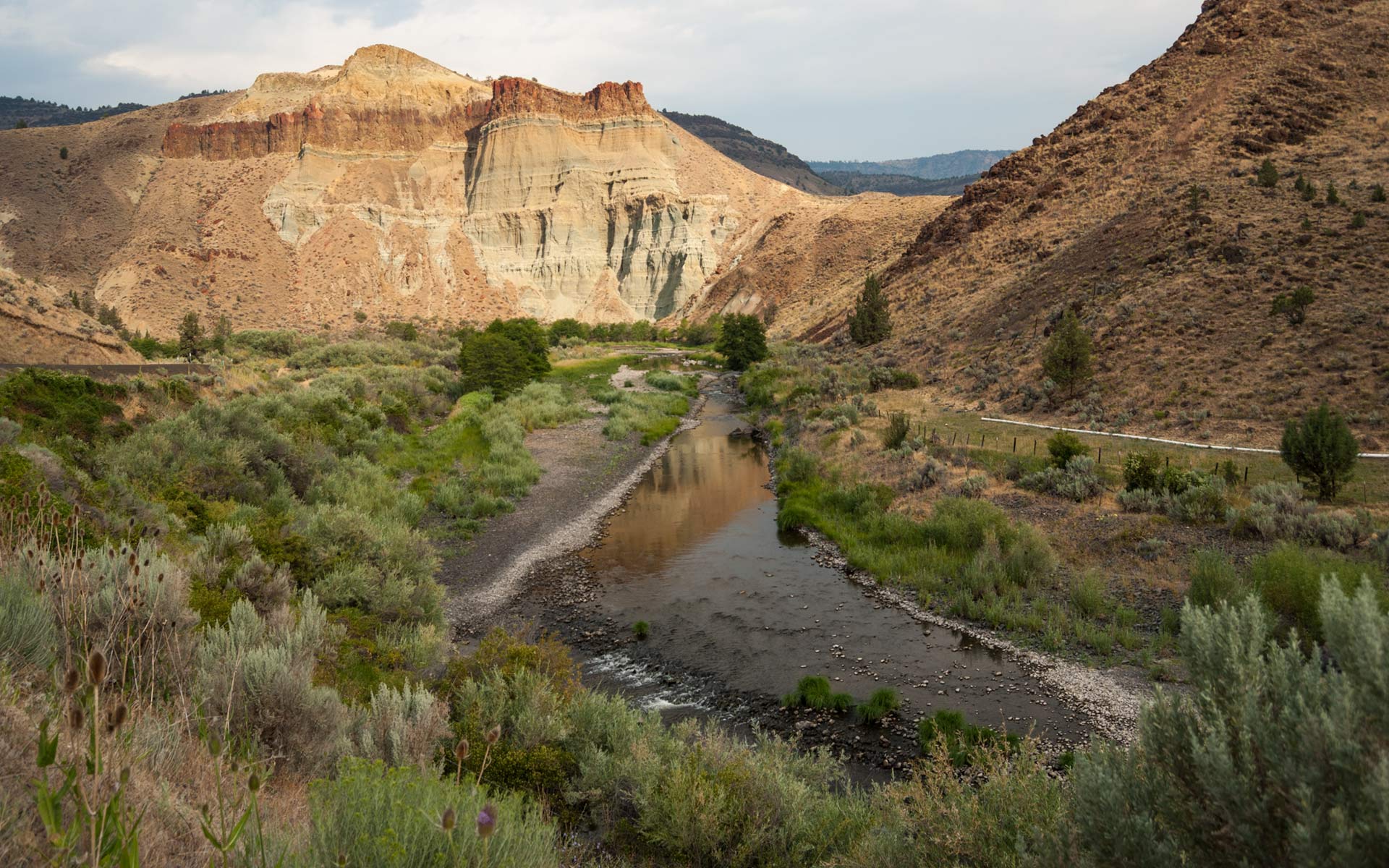
Cathedral Rock – It is located approximately 5 miles from the visitor center. It is to your left hand. The John Day River and the road OR 19 make a sharp bend of almost 180 degrees. Park your car after this sharp bend at the soft shoulder. You have two main options to photograph Cathedral Rock. The first is walking back to the bend and climb up a little hill to have an almost panoramic outlook of the landscape. The other option is to walk after the bend as far as possible east to include the John Day River in the foreground leading to Cathedral Rock.
Blue Basin – The name of this place already says it all. The surrounding hills are eroded and the clay underneath has the most bizarre blue and green colors. The photographic compositions are numerous, but will require some footwork. Leave the car at the primitive parking lot. You have two options. The first one is the Blue Basin Overlook Trail which is a 3 miles, strenuous, but rewarding, loop trail which brings you to a spectacular vista overlooking the John Day River Valley. It is dusty in places and may be impassable in wet weather. Elevation gain is 600 feet. The second option is walking into the blue basin itself.
Visitor Center – Additionally to the already mentioned visitor center there are also two interpretive facilities: the Thomas Condon Paleontology Center, and the Cant Ranch Historical Museum. The Paleontology Center features exhibits, interpretive programs, and audiovisual presentations on fossils, geology, and the processes of paleontology, while the historic Cant Ranch house features an exhibit on cultural history of the John Day Valley. The Cant Ranch Museum, located one-quarter mile away, serves as the monument headquarters and contains indoor and outdoor exhibits relating the history of human settlement on the ranch and regional area.
I recommend to visit all three to have a broad view and understanding of this entire area of the John Day Fossil Beds National Monument. More to the end of the day, search for the right foreground elements to take your late light shots of the Sheep Rock which dominates the entire area.
Last update: November 24, 2011

