- Destinations
- AZ
- Vermilion Cliffs
- White Pocket
Are you sure you want to go to the White Pocket? You must be a die hard! Before you start dreaming about getting there you should read my advices given here VERY carefully. This is not for the ill prepared. Not for the faint hearted either. Do not get me wrong, it is not for the crazy adventurer. This is for the seasoned, experienced and well prepared adventurer and photographer. I have seen too many people stuck on this road throughout the last several years. Each time I went to the White Pocket I had the privilege to unstuck one to two cars.
South Coyote is stunning, but wait until you see White Pocket. The entire area is much smaller than South Coyote Buttes. Despite getting the feeling of overview pretty fast, the richness of geologic variety is absolutely mind boggling. It is worth going there. There is nothing a like it in the entire Southwest.
Some additional advice: If you get stuck in the sand, you will need to pay serious money to be rescued. Pack enough food and water for a few days, a sturdy shovel, a tow trap, or even better, a winch attached to the front of your car. Take some strips of old carpet to put under your wheels in case you get stuck. By all means, never ever go alone. Let someone at home know where you are going.
OK, the good news? As of this writing you do not need a permit to go and stay there.
Getting to the White Pocket:
There are two ways to get there and both are described already under the travelogue South Coyote Buttes. Important is to get to Poverty Flat Ranch where both routes described at the South Coyote Buttes travelogue merges into one. Here you will see the remaining tower of an old windmill. Take the road that passes right of this tower heading northeast-east. You drive up a gentle hill and on the top is a huge round iron water reservoir to your left. You will pass a corral at 2.0 miles and 2.3 miles and cross a gate at 2.7 miles and another one again towards the end of your trip from Poverty Flat to White Pocket. The distance between these two points is about 6 miles.
The tricky part of this trip is a relatively steep hill which, with the sand and the deep ruts left by former visitors can make it quite challenging or even impossible. If you are able to make it to the top and fear that you might get stuck at the other side driving back towards House Rock Road I strongly recommend you park your vehicle at the roadside and hike the remaining 2 miles until you reach White Pocket safe and sound.
Taking shots:
After a long and exhausting drive through the sand-scape you finally will reach the end of the road. Did I just say road?. Park your car at the parking area. Walk up the small sandy saddle and the most amazing sight awaits you. White Pocket Butte, a huge white butte is located to the east. To the west you see a white and red plateau. White Pocket is what lays between these two.
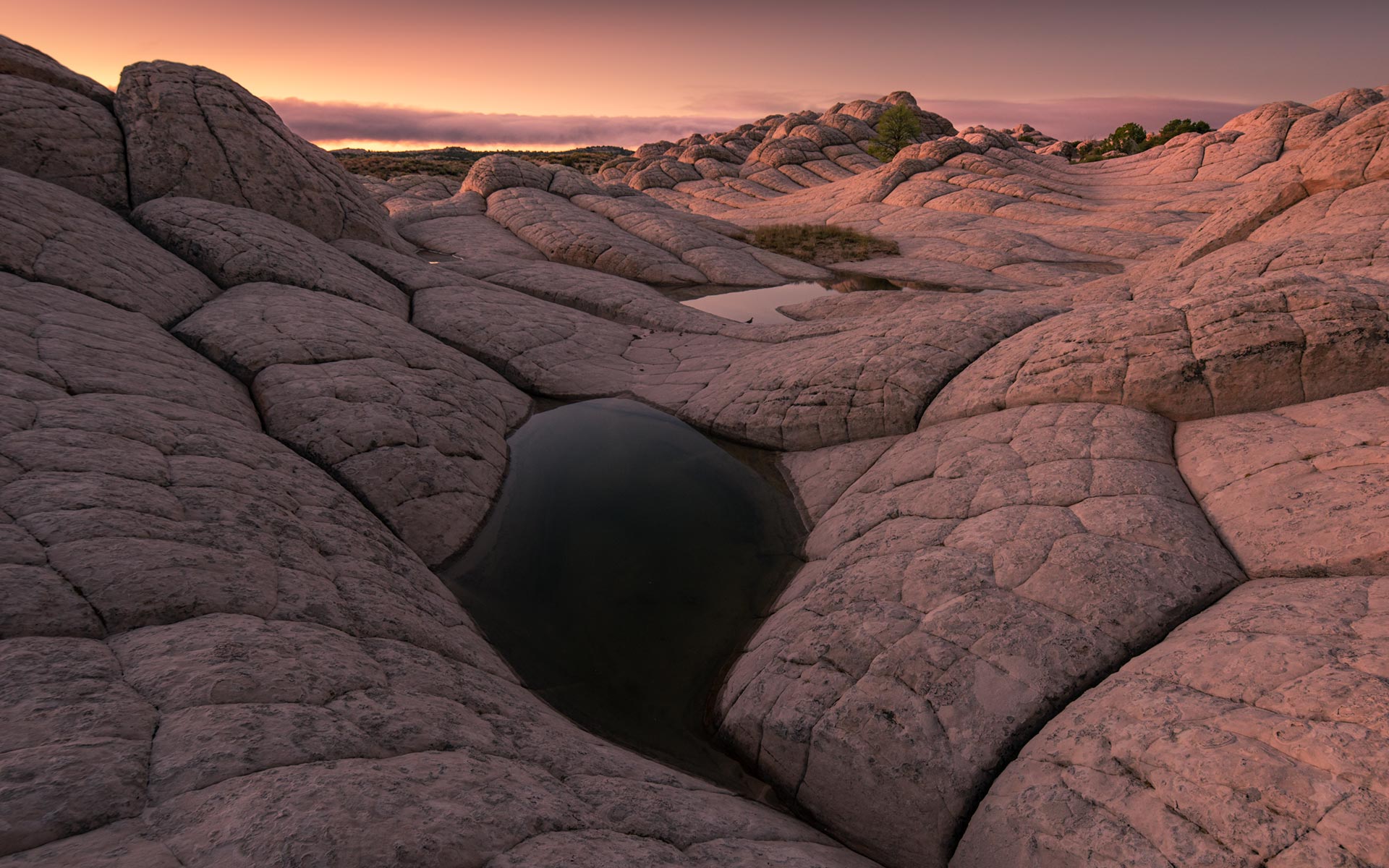
The entire area is covered with a white/greyish brainrock that is just a few inches to one foot thick. There are constant breakthroughs through this brainrock with the appearance of red swirls, yellow rock and so on. There is no way that I can describe this all here. Your camera will not stop working and yet I advise you first to walk around and absorb the raw beauty. Get to a high point to gain an overview of the place. You will see as far as the pink cliffs of Bryce Canyon, the tall silhouette of Powell Point and Molly’s Nipple on a clear day.
The white sandstone and all the other subtle colors will not look at their best at midday. Try to be there until late afternoon, or even better, stay overnight to catch sunset and sunrise. Aim towards White Pocket Butte with some brainrocks in the foreground at sunrise.
Any lens will go here. Above all, take plenty of time to enjoy the spectacular crossbedding and swirls. Shape, color, texture, and intricate details all contribute to an extraordinary sensory experience which you will want to capture again and again. Make sure you have enough storage and juice in your batteries.
Last update: August 11, 2017

