Zabriskie Point
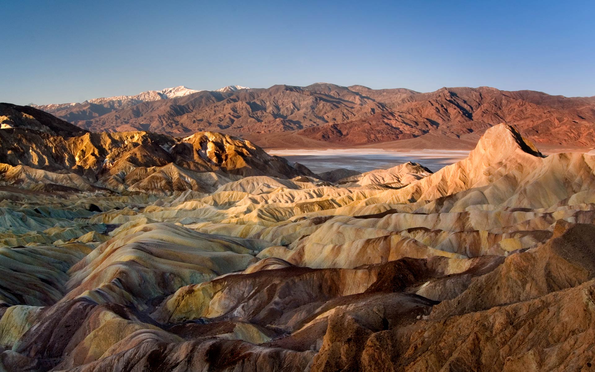
Zabriskie Point is a part of Amargosa Range located east of Death Valley noted for its erosional landscape. It is composed of sediments from Furnace Creek Lake, which dried up 5 million years ago—long before Death Valley came into existence. The area is probably one of the most iconic spots in this national park.
Getting there:
The access to the area could not be easier. It lays almost central in the national park. If you are staying overnight at Furnace Creek it is a short 5 mile drive on Route 190 to the Zabriskie Point parking lot. If you are staying overnight at Stovepipe Wells you need to calculate a 30 minute drive along Route 190.
Taking shots:
Zabriskie Point is a very popular spot among photographers. It’s accessibility could not be easier and the view is truly breathtaking.
Be there at dawn and early enough to make your claim among the crowd of photographers. The best location is right at the parking area. The sun will rise behind you and the first place to shine is the Panamint Mountains in the far background. You might be even lucky to get snow on the top of the Telescope Peak enhancing the drama between the colorful desert in front of you and the snow in the far. Next shines Manly Beacon, turning into a deep orange color. As the sun keeps rising, more of the landscape is turned into a golden hue mixed with brown tones.
The compositions are endless and are best created with a wide angle lens and telephoto to allow a varied array of possibilities. The use of ND grad filter can be of extreme value when taking a wide view composition where the foreground is still dark and the Panamint Mountains is fully sun exposed.
Last update: July 25, 2014
