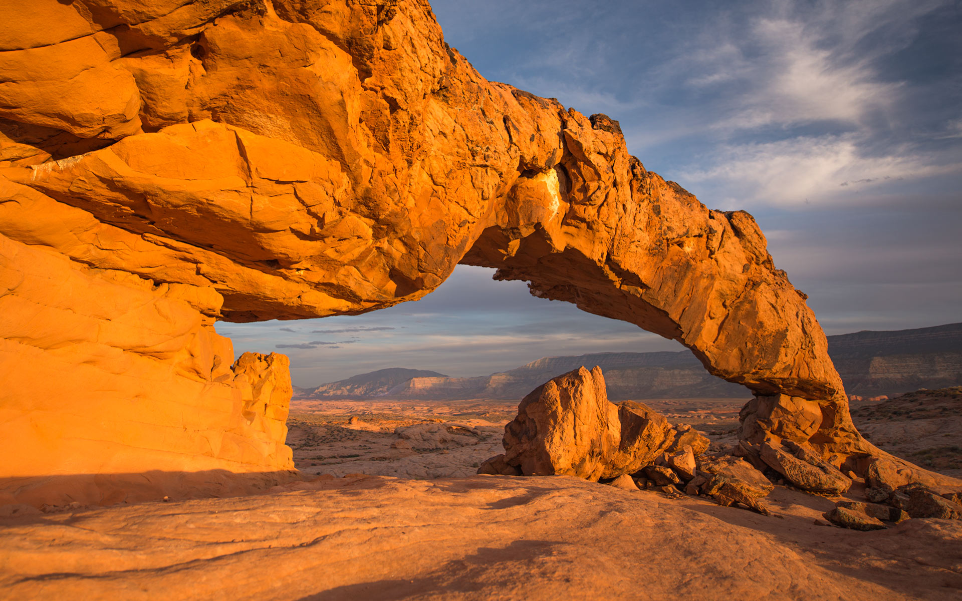
It takes a 45 mile drive from the town of Escalante to Sunset Arch’s trailhead and than another mile of hiking until you stand in front of this arch. Through its rather huge bow you can see the humpback-like Navajo Mountain in the distance. This view is certainly a surprising moment as after all these miles of driving and hiking you might not expect such a large and somewhat displaced looking geologic feature standing out of the surrounding sandy bench lands. It gives almost the impression as if this arch is a remaining element of very ancient times. Everything else was covered, transformed, weathered and only the slick rock on which the arch rests and the arch itself withhold the metamorphosing forces of nature.
The longer you stay at this rather remote spot and let the landscape sink in you will get the feeling of being displaced in time. This feeling will get even more intense once the sun starts to get close to the horizon. The arch starts to glow while the sky, depending on the meteorological conditions, will turn into a colorful or dark backdrop. The light’s contrast between the arch and the sky provides the illusion that the rock is alive for a brief moment, freed from its enchantment. As soon as the sun is set this magical moment will be gone abruptly reminding you that it is time to go back to the car.
After such an experience, it is easy to explain why this location is so successful with photographers.
Getting to Sunset Arch:
The access is easy, but it consists of 45 miles long drive from the town of Escalante. Expect to take at least 1 1/2 hours driving. This should already give you an idea of the road condition. A 4×4 car with high clearance is recommended, although not an absolute necessity.
Take UT-12 heading southeast for about 5 miles to enter right onto Hole-in-the-Rock Road. After about 36 miles turn left on Fortymile Ridge Road (BLM 270). Follow this track for about 3.5 miles and leave your car at a primitive parking area situated to the left side of the road (N37 23’11” W111 3’27”). Following the track you will see approximately 1/2 mile distant a big round water tank on the top of the hill.
From the parking area you will start a 1-mile hike. There is no trail or cairns to guide you. You will not see the arch from the parking spot. Navigate cross-country south-southeast with the help of a compass and/or with a GPS with the arch located at N37 22’33” W111 2’55”. Count on 1/2 hour to reach the arch.
Having a flash light among your gear will be of great value once you trace your way back the car after sunset.
Taking shots:
During the day the arch and the slick rock plateau has a dull, non-spectacular appearance. In contrast, at late afternoon and especially around sunset the rock color transforms into a visually attractive brownish-orange. The best time of the year to achieve this effect is late spring to early autumn. The sidelight enhances then greatly the details and contrast in the arch.
You will be best server with a wide-angle or mid-lens.
Special elements to this location can be added with the presence of mid-crescent to close full moon. Another nice tweaking around this composition are waiting after sunset for star-trails with or without fill in light on the arch.
Last update: July 28, 2013
