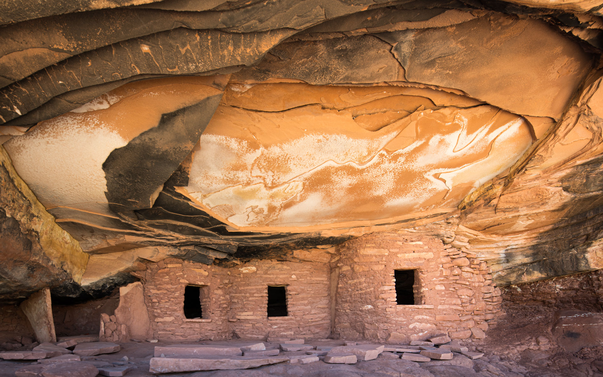
Fallen Roof ruin is one of the many Ancestral Puebloan cliff ruins in the Cedar Mesa area. It certainly is one of the most if not the most iconic ruin of Cedar Mesa. Its image is often seen in photographic magazines, calendars and photos, and for a good reason, the ruin with its three rooms is well preserved. But, what makes all the difference is the ceiling of the alcove. At some point in time a large slab of rock above the ruin fell, leaving a bright orange surface above the ruin. A seep that ran through the layer before it collapsed left bright white mineral deposits. With the lighting on the ruin and the ceiling you achieve really very dramatic images.
Visiting any of the Cedar Mesa ruins is a special privilege. To the decedents of the Anasazi, these sites are sacred and should be treated as such. No one should touch, crawl in, or remove anything. Take your pictures and leave only a footprint.
Practical advices:
A visit to Cedar Mesa and its ruins can be done at any part of the year. Most recommendable are Spring and Autumn. Summer is for obvious reasons very hot and Winter can be extremely cold. At my last visit there I recorded 14°F over night. I guess it is not necessary to say that I spend a very uneasy night in my tent.
Getting to the Fallen Roof Ruin:
Fallen Roof ruin has a relatively easy access. The only limiting factor can be if you get there during rainy season as the access Cigarette Springs Road will get impassible!
Turn off Hwy 261 East onto Cigarette Springs Road, which is 13 miles south of the intersection of Hwy 261 and Hwy 95. At 0.9 miles, you will come to a closed gate with a BLM Monticello registration/sign in sign. Sign in and pay the $2 (day use per person)or $5 (day use + overnight per person). This permit will be good for all other ruins in the area too. The trailhead parking is exactly 2.5 miles from the gate. It is simply a left turn to the North. This turn is unmarked. Drive in as far as you can and park. At the end of the road you will see a simple sign that says ‘Trail’.
The trail is easy to follow. The first 1/3 mile is a very easy and comfortable hike on top of the mesa covered with trees. Than it drops down into the canyon. At the bottom, you will see a number of cairns. Continue hiking to your right down the canyon until you come to a much wider area of the canyon. You will see in front of you a gigantic rock tower. Pass it leaving by following the canyon to the right. Past this you will start to see sheer walls ahead, on the North side of the canyon. Pretty soon you will see at the North side of the canyon the ruins. Fallen Roof Ruin is the first one you come to, approximately 1/4 mile past the wider area of the canyon. It is about 100-150 feet above the canyon floor, but really an easy scramble on slickrock to get up to it. The GPS positioning for the ruin is N37.396335 W109.872443.
The entire roundtrip hike are about 2.3 miles. It took me 20 minutes down to the ruin and 25 minutes back to the car.
Photographic advices:
There is a very particular moment of the day to be at Fallen Roof Ruin. The sunlight has to reflect from the canyon in mid-morning to cast a warm glow on the alcove. Early morning and after sunet the light is dull and after mid-day the sun shines into the alcove and the contrast are a killer.
The optimal lens is a wide-angle in the range of 14-24mm.
Last update: February 21, 2015
